Ornitho.cat allows submitting observations with a precise location either if you submit complete lists or casual observations. Here we will explain how to register the precise locations. First of all, it’s important to keep in mind that precise locations entered at Ornitho are only visible by the observers, by the portal administrators and by the local administration entities who use the data. The other users can visualize the observations associated to a yellow point (specific site) or blue point (UTM 1x1 square).
1) Standard list with precise locations
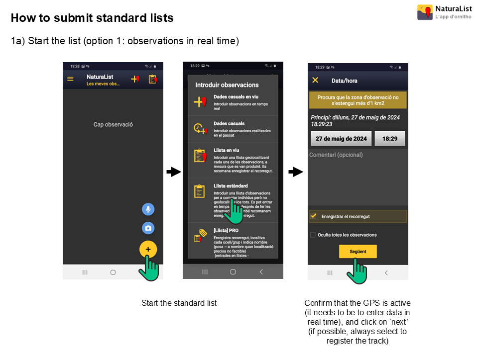
If you want to give maximum value to your data, the best option is to submit complete lists and assign a precise location to those observations that are more interesting regarding conservation status (see for instance our list of endangered species) or personal interest (e.g. species that aren’t common at your local patch). Here we explain step by step how to do it using the NaturaList app.
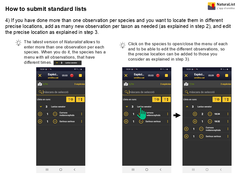
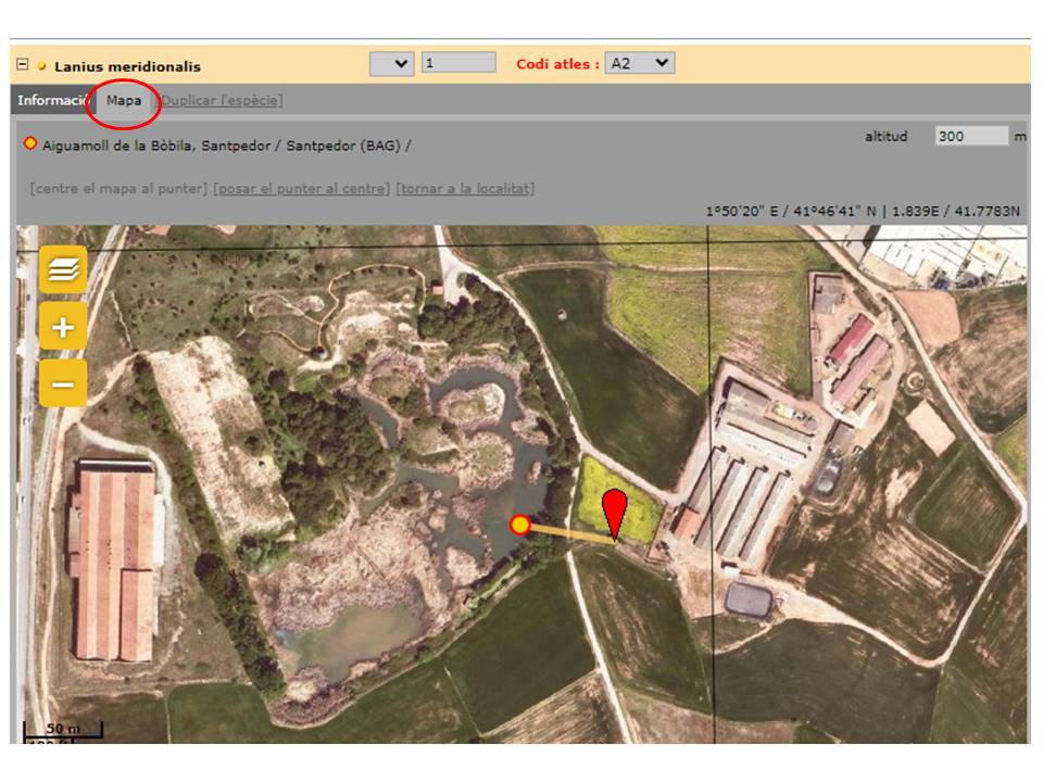
If you submit the standard list using the webpage, you will see that for each species there is a tab named ‘Map’ where you can choose a precise location for each observation. In case of observing individuals from the same species in several locations, you can select ‘Duplicate species’ and automatically a new row with the same taxon will be added to the list.
2) ‘Live’ list.
The main difference between the standard list and the live list is that the latter requires all observations submitted indicating a precise location. Therefore, this type of list should only be used if you want to indicate the precise location for all birds detected. Otherwise, the best option would be to submit a standard list.
The fact that the precise location has to be noted for all sightings makes live lists more demanding, both to the level of skills and attention needed, for the observer. For this reason, we strongly recommend that the track is always registered and that the duration is short in distance and time (maximum 1 km).
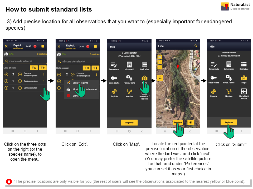
3) Casual observations
Even though the data is more valuable if collected on a complete list, it can be also very useful sometimes to submit casual observations with precise locations, especially for those of special conservation interest or scarce (marked with a yellow or a red dot).
In the NaturaList app, all casual observations (live or not) are submitted using precise location. On the web, you can click on the map anywhere to submit a casual observation in any precise location, which will automatically link to a nearby point (blue or yellow).
Attention with the GPS!
In order to submit data using the NaturaList app it is essential to make sure that the GPS function of the mobile phone is properly activated and that the precision is good (it can be done by looking at the little text referring to the precision of the GPS on the top left corner of the screen, and/or by making sure that the emoji that marks the position is smiling). If the app has been accessed for first time in a few days or several hours, it’s highly recommended to wait a few seconds before starting to submit observations in order to make sure that the GPS is positioned correctly.